Intelligence
Roadmap

Beyond air: water, soil and noise

The platform is built to carry more than one environmental layer. These are the next ones — planned, not yet live.

Roadmap

Water

Rivers, lakes and wells observed next to air data — for municipalities, utilities and agriculture.

Planned scope

  • Temperature, pH, turbidity and conductivity
  • Stations on rivers and lakes shown on the same map
  • Threshold alerts through the panel and Telegram
Roadmap

Soil

Soil conditions for agriculture and land management, organised by location.

Planned scope

  • Moisture, temperature and salinity
  • Field-level history for farmers and cooperatives
  • Combined view with local weather and air data
Roadmap

Noise

Environmental noise mapped by zone — traffic, nightlife and industry.

Planned scope

  • Continuous decibel levels per zone
  • Day / night comparison against legal limits
  • Public noise layer on the city map
Why it works

One platform, many layers

Every new layer reuses what already runs in Strumica: the map, the panel, reports and alerts. A pilot only needs the right sensor and a location.

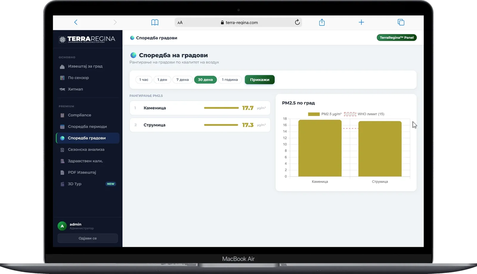
Analytics panel comparing cities
The same panel will carry new layers
How a pilot works

From question to
a new live layer.

The same process we used for air in Strumica.

Question

What do you need to know, where and for whom?

Sensor

We select and test suitable hardware for that parameter.

Pilot

A few stations go live on the map and the panel.

Scale

If the data is useful, the layer grows to more locations.

Already running for air

What a new layer
will get from day one.

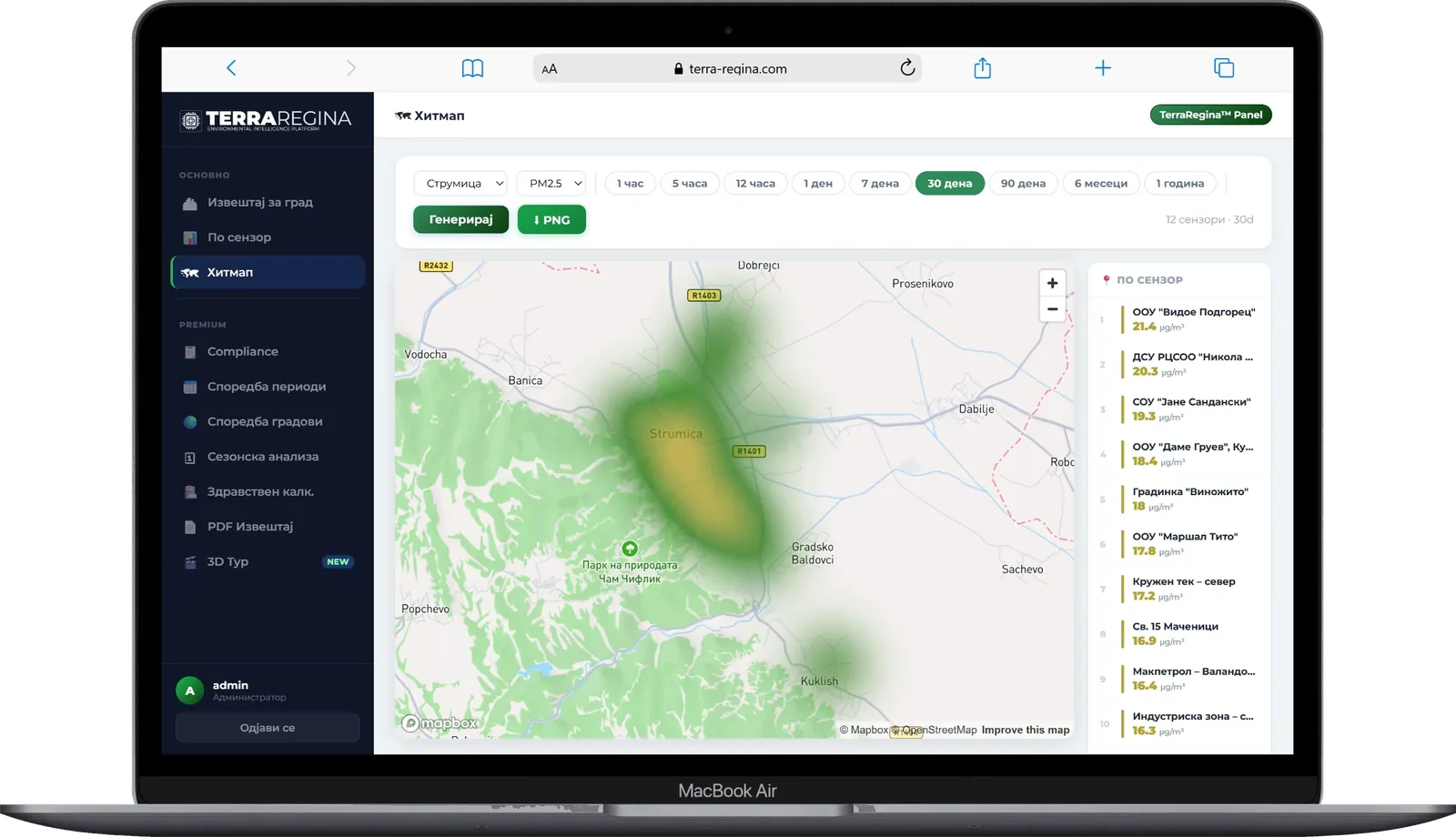
Heatmap of PM2.5 across Strumica in the analytics panel
HeatmapWhere pollution concentrates across the city.
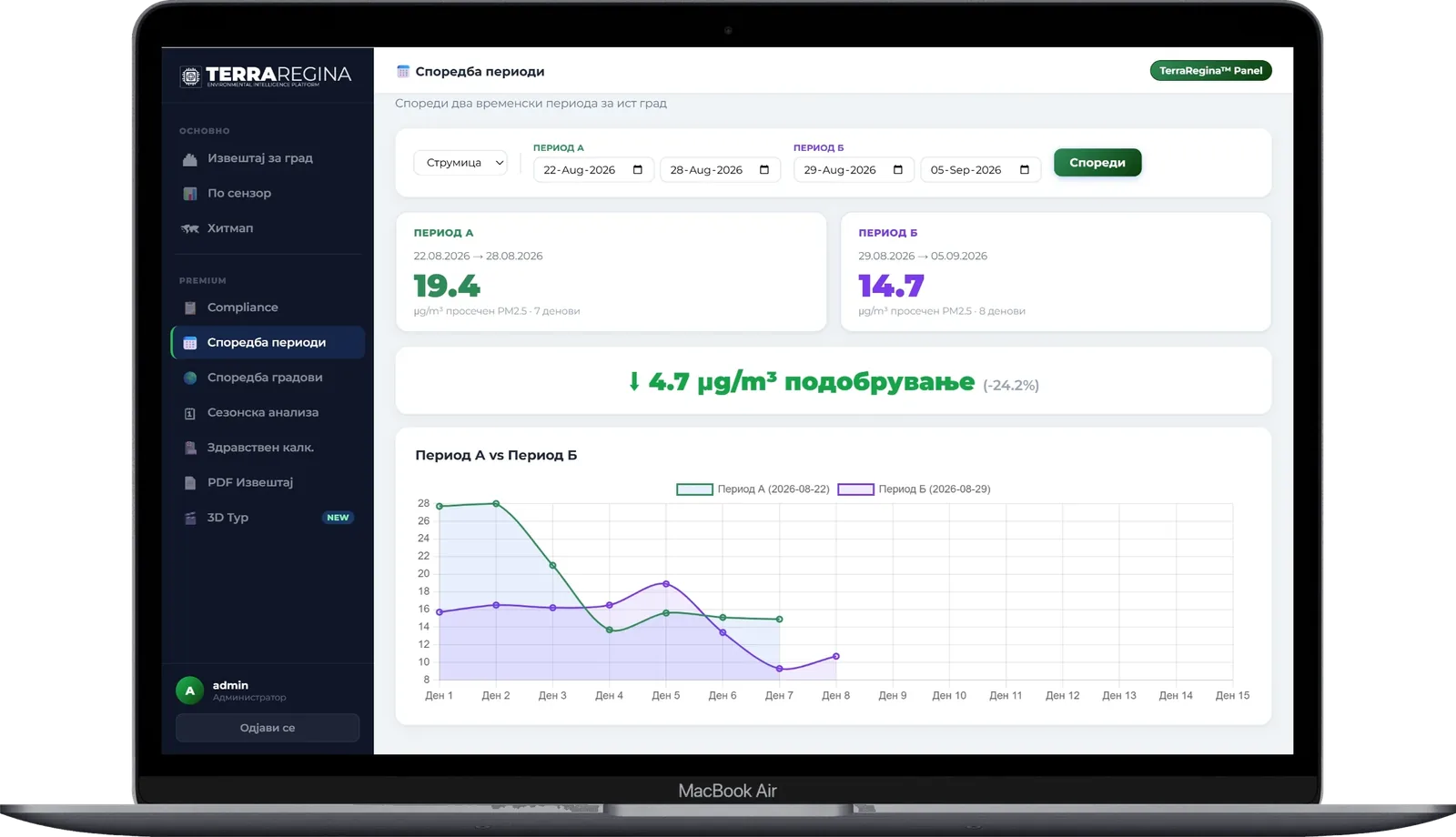
Comparison of two time periods in the analytics panel
Period comparisonDid a measure work? Compare before and after.
Talk to Terra Regina

Have a water, soil or noise question?

We are selecting pilot locations for new layers. Tell us the site and what you need to measure.